• Ahoy and Welcome to the New SSS Forums!!

    As you can see, we have migrated our old forums to new software. All your old posts, threads, attachments, and messages should be here. If you see anything out of place or have any questions, please scroll to the very bottom of the page and click "Contact Us" and leave a note with as much detail as possible.

    You should be able to login with your old credentials. If you have any issues, try resetting your password before clicking the Contact Us link.

    Cheers
    - Bryan

Bay Bridge F-G span

MCarnall

New member
The F-G span of the bay bridge is "closed" and a temporary channel has been established further east at the I-J span. A 15Dec08 LNM states:

"SAN FRANCISCO-OAKLAND BAY BRIDGE REPLACEMENT-EAST OF YERBA BUENA ISLAND(YBI): Mariners are advised to avoid the construction
area by using the main navigational channel west of YBI or the alternate channel, piers I-J, east of the construction site (see Alternate Channel
Marking diagram in the enclosure section at the end of the LNM)"

Does that qualify the F-G span as an "area designated by the U.S. Coast Guard as prohibited to small craft" (2009 SSI, section 14,a,ii) and thus a restricted area? Seems like all spans have been considered fair game in the past even those where active construction was taking place.

Mike C.
 
Chartlet of Bay Bridge Construction

Here's the reference:
http://www.navcen.uscg.gov/LNM/D11/lnm11032009.pdf

The description starts at the bottom of page 10. Scroll to the end of the document to see the chartlet of the area and the area 'to be avoided'.

- Mark

I uploaded the chartlet as a JPEG and a PDF file for easy viewing and printing (allegedly). The images were too big to include in this reply message. They are identical in content.

Click on the link below, when the iDisk directory appears, click on the download arrow on the far right of the line item you wish to download for viewing and printing.

http://idisk.mac.com/adjuvantjfoster-Public?view=web


John
Blueberry, Nonsuch 22 Sail #48
 
Last edited:
Thanks for the question, Mike. I don't know the answer. I've read the document and looked at the chart and probably will avoid the construction area but I don't know if this advisory constitutes the same level of restriction as the long wharf near the Richmond Bridge? Can/will the USCG chase boats out of the area?

We (Max and I) discussed this with Kami before the Skippers Meeting. I was inclined towards restricting the area but was swayed by the argument that a lot of skippers wouldn't get the information and having raced in the TBF for years, they would assume that nothing had changed and chaos would follow.

If anyone has the answer, please post it. Opinions are certainly welcome but won't be particularly useful in making the decision of whether or not we have to restrict the area.

If we don't get an answer by tomorrow, I'll call the USCG for clarification.

Bill Merrick

Hi Bill -

in reading thru the documents, the local notice to mariners simply states that mariners are 'advised' to avoid the area. The use of 'advised' implies that the area is not restricted, and rather is simply not recommended.

It would be worth a phone call to the USCG to advise them that a ton of little sailboats are planning to battle through the area shortly.

- rob/tiger beetle
 
Guys,

For what its worth I sailed through this area today just to check it out before the race. I went north through the I-J span after noon and returned through the same span heading south after dark.

The I-J span seems to be a pretty good choice for a temporary channel since the bridge piers on both the old bridge and on the new bridge are spaced about the same distance apart. Thus the channel is a straight and clear path. On the north side of the bridges there was a line of several barges east of what would probably be a normal route north after passing through the I-J span.

The normal channel (F-G span) is indeed rather full...a barge and several mooring balls. It would probably be easy enough to sail through this area in ideal or good conditions, but I will avoid it on race day. As you all know under normal westerly flow this area has shifty winds and the currents can be strong too...add a few dozen other boats and things could get interesting.

After dark the many mooring balls in the normal channel were marked with little flashing lights, but they were not all that easy to see. The temporary channel (I-J span) is marked overhead with green lights on both bridges so finding the temporary channel after dark wasn't too hard.
 
Thanks, Rob and Richard.

I talked with VTS this morning and alerted them about the number of boats, race course and race times. They were, of course, aware of the race but I think they appreciated the heads up.

At this point, the construction area is not "restricted" but any boat that chooses to enter is doing so at its own risk. I would advise skippers to err on the side of prudence.

Does anyone have a recent photo of the area, with the barge, bouys, etc?

Bill Merrick
 
Bridge Building Activity

I sailed through the area on Saturday to get a closer looker but forgot to take a picture.

The big barge in the middle of the F-G span is a major obstacle. I drifted close to one of the mooring balls when the wind got shadowed by the island and towers.

The EYC midwinter racers headed back through the I-J channel. It's a good idea to stay away from the construction area even if it's not a completely prohibited area.
 
Does anyone have a recent photo of the area, with the barge, bouys, etc?
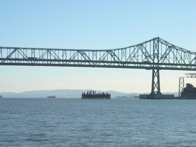
This thing sits where we sailed through last year:
GHSpanLookingSouth.jpg
 
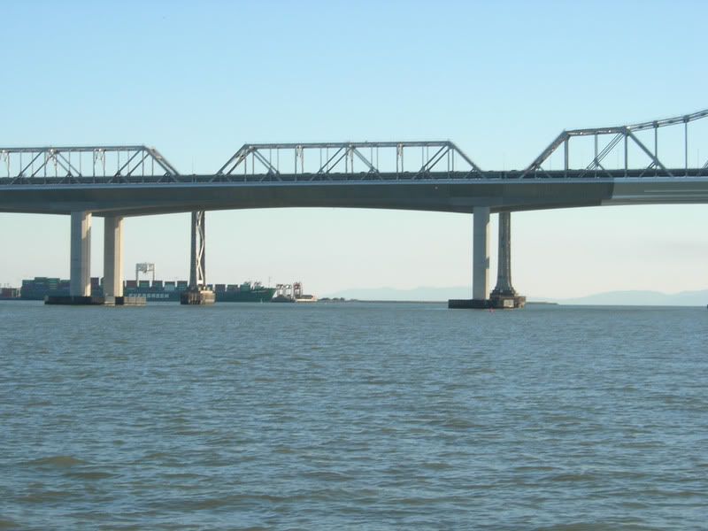
This is the look of the Alternate Channel going South - the buoys are small:
IJSpanLookingSouth.jpg
 
Last edited:
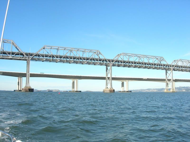
Your approach to I-J from the South side (looking North):
IJKSpansLookingNorth.jpg
 
Last edited:
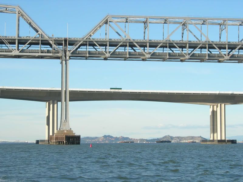
This is the Alternate Channel looking North:
IJSpanLookingNorth.jpg


P.S. - If there was an F-G segment, it would be Treasure Island itself according to my chart.
 
Last edited:
I stand corrected

Bob: you are right, it is the G-H span that is closed. In addition to the structure shown in your pictures there are currently (Tuesday morning) two derrick barges located adjacent to the structure at midspan.

Mike C.
 
Thanks for the corrections on the identification of the "closed" span. If anybody's counting towers to find the alternate channel, it'll be useful to know that the normal span is G-H and the alternate is I-J.

Seems to me there should be one more Local Notice to Mariners published before the race. It would behoove all racers to check it out before leaving the dock Saturday.

From my point of view, even if the next LNM actually flat-out prohibits craft from using G-H span, we do not need an amendment to the sailing instructions. Rule 14.a.ii of the SSIs covers it. Naturally we would publicize the closure on VHF.

Be careful out there!
Max
 
Back
Top